01 · Quarry regulation & revenue
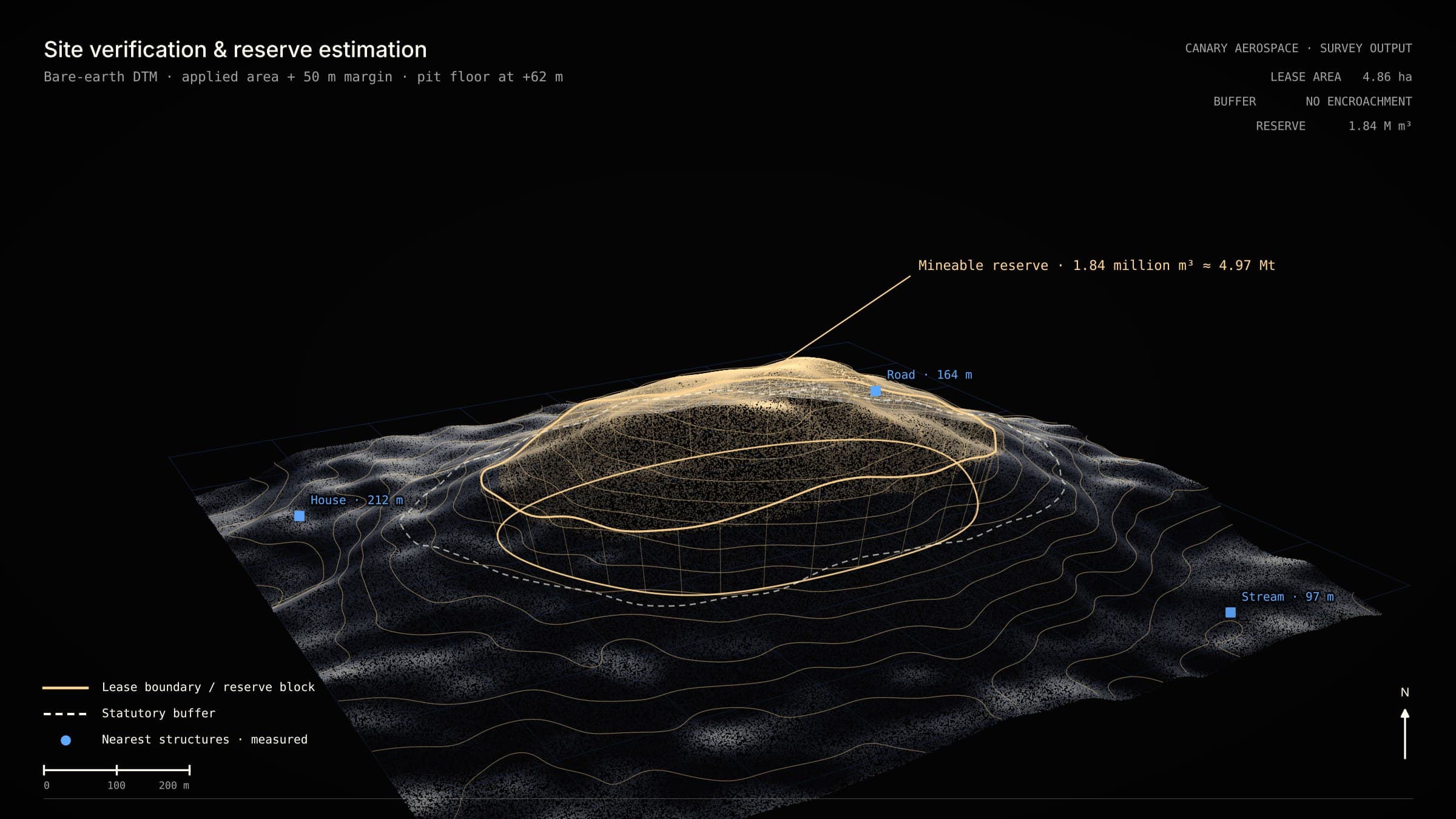
Site verification & reserve estimation
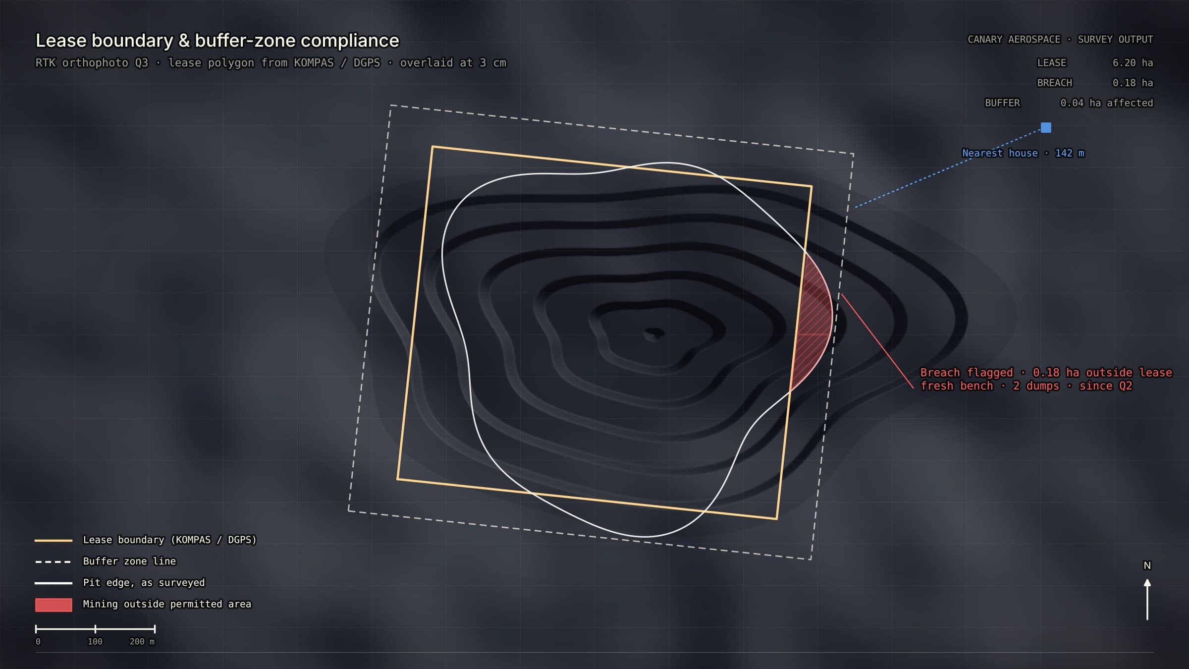
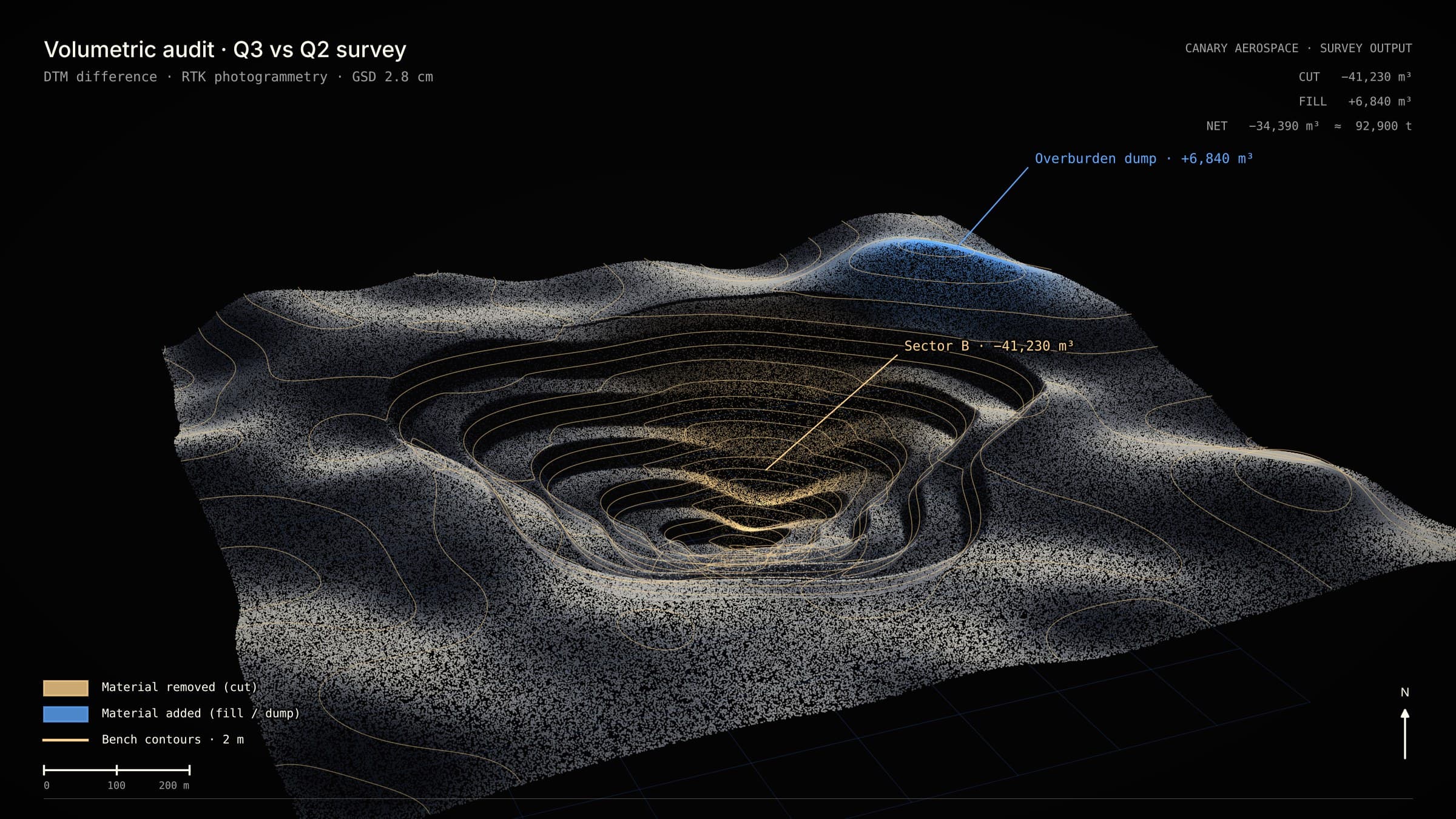
Before a Letter of Intent, the applied area, its slopes, buffers and mineable reserve must be confirmed. One or two mapping flights over the site and a margin around it produce a bare-earth terrain model, with reserve computed inside the lease boundary, net of buffers, down to the planned pit floor.
- Sensors
- LiDAR · RGB · RTK/PPK GNSS
- When
- Once per application
- You receive
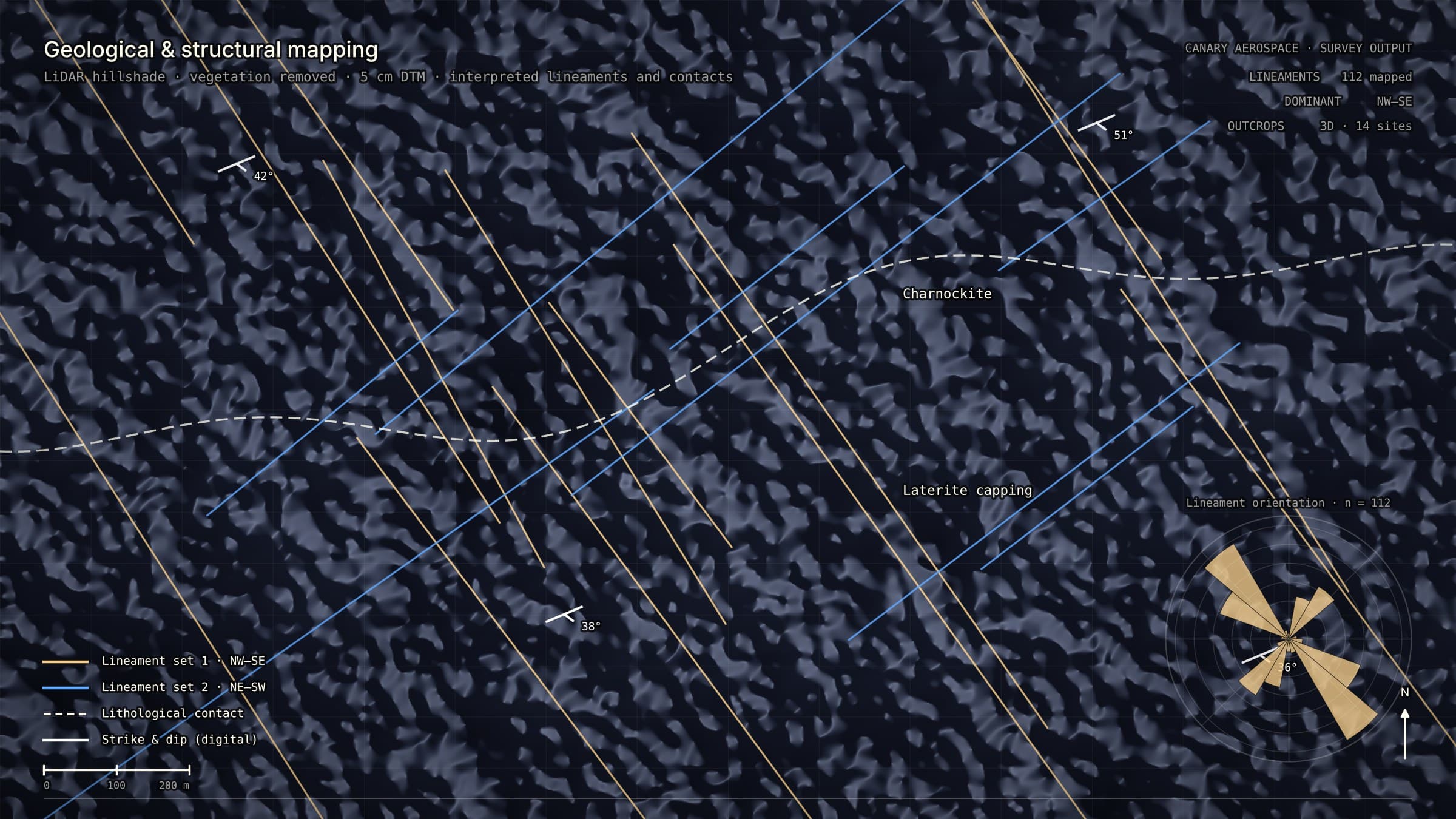
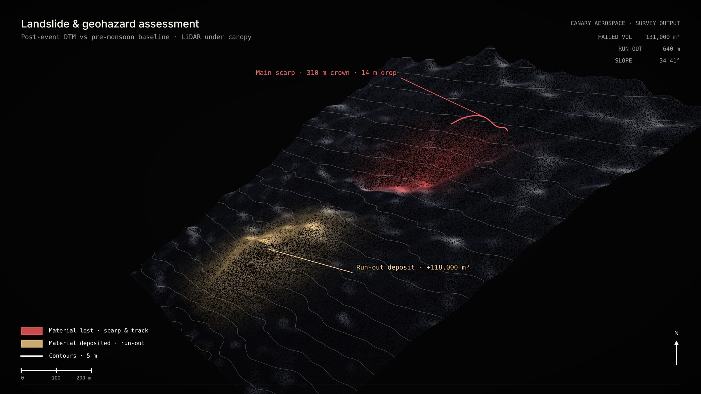
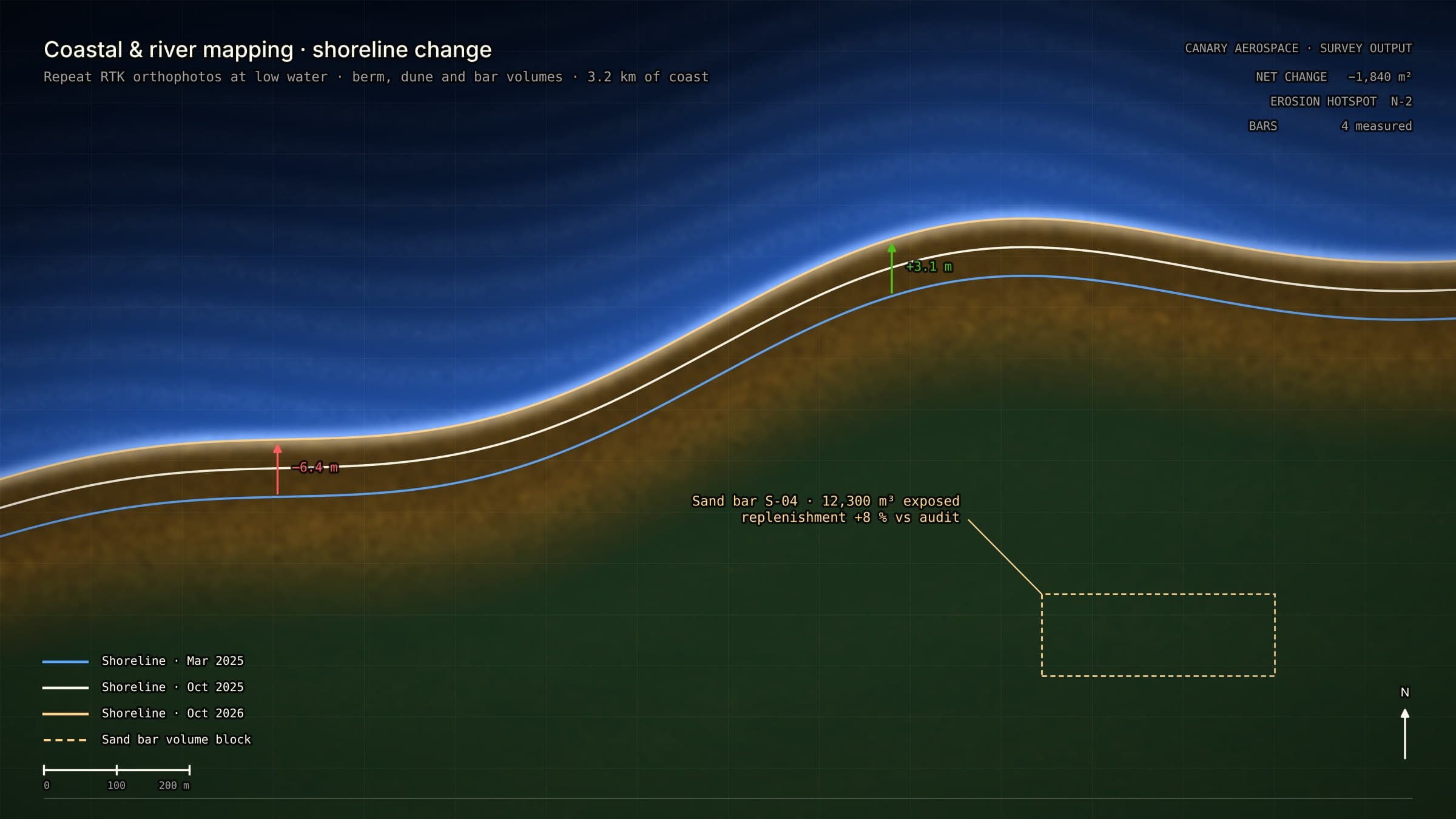
- Drone survey report · reserve volume and tonnage · orthophoto, terrain model, contours · buffer and distance map